


 Add as a preferred source on Google

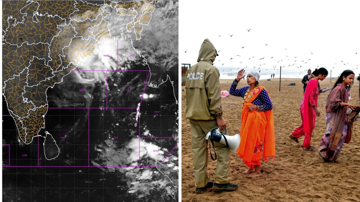
Cyclonic Storm Akvan has begun to make landfall, with the outer rain cloud band entering land along the North Andhra Pradesh and South Odisha coasts, according to the India Meteorological Department.
The weather phenomenon, which was a severe cyclonic storm until Thursday night, weakened into a cyclonic storm by Friday morning and lay centred 110 km southeast of Kalingapatnam and 170 km east of Visakhapatnam in Andhra Pradesh, 170 km south of Gopalpur, and 150 km south-southwest of Puri in Odisha, the IMD's latest alert said.
“It is likely to cross the North Andhra Pradesh, Yanam, and South Odisha coasts between Narsapur and Puri, close to Gopalpur, by noon on Friday,” the IMD said.
Wind speeds are expected to be 90–100 kilometres per hour, gusting up to 110 kilometres per hour at times. "The centre of the cyclone, known as the eye in meteorological terms, will cross the coast near Gopalpur in Odisha. Southern Andhra Pradesh will experience wind speeds of 90–100 kmph. In Odisha, wind speeds are expected to be 70–80 kmph," IMD Director General Mrutyunjay Mohapatra said. He added that the system would gradually weaken while moving northwards through Odisha.
Odisha is already witnessing the effect, with the Gopalpur coastline experiencing rough sea conditions and gusty winds. The capital city of Bhubaneswar, too, is experiencing heavy rain and gusty winds. Heavy rainfall triggered by the cyclone has raised the risk of flash floods and waterlogging in 18 districts over the next six hours.
The IMD has asked ports at Gopalpur to hoist Great Danger Signal 10 (GD-10), while Paradip port has been asked to hoist Great Danger Signal 9 (GD-9). Dhamra port has been advised to hoist Local Cautionary Signal 3 (LC-3).
The weather agency has also warned that a storm surge of 0.5 to 1 metre above the astronomical tide is likely to inundate low-lying areas of coastal Odisha, particularly Ganjam and Puri districts, around the time of landfall.
The storm that was earlier expected to cross along mid-coastal Andhra Pradesh changed course and veered towards North Andhra Pradesh and Odisha. The IMD issued a red alert for Srikakulam and Vizianagaram districts, an orange alert for Parvatipuram Manyam, Alluri Sitaramaraju, and Anakapalli districts, and a yellow alert for Kakinada.
It forecasts extremely heavy rainfall at isolated places in Srikakulam and Vizianagaram, heavy to very heavy rainfall in the orange alert districts, and heavy rainfall at isolated places in Kakinada.
A red alert indicates extremely heavy rainfall exceeding 20.44 cm in 24 hours, an orange alert very heavy rainfall of 11.56 cm to 20.44 cm, and a yellow alert heavy rainfall of 6.45 cm to 11.55 cm.
Trains cancelled
The South Eastern Railway announced the cancellation of at least 28 express trains, most to Puri or passing through the temple town, for Friday as a precautionary response. The Shalimar-Puri Express and Bhanjpur-Puri Express, scheduled to depart on Thursday, were cancelled. Some trains to West Bengal, Odisha, and Jharkhand have also been cancelled.
The Howrah-Puri-Howrah Vande Bharat Express has been cancelled on Friday, the official said. The other trains cancelled on Friday include the Puri-Bhanjpur Express, Bangriposi-Puri-Bangriposi Express, and the Brahmapur-Tatanagar-Brahmapur Express.