



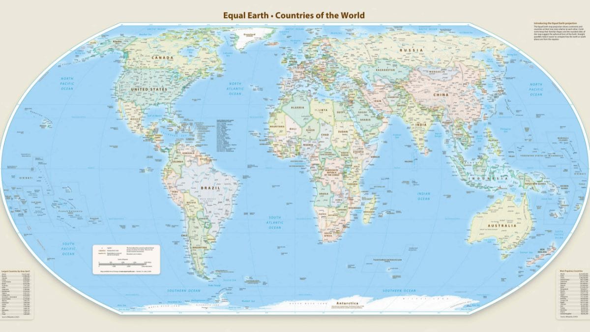
The United Nations General Assembly on Friday endorsed a new world map that will represent the African continent in a more accurate size. The “Correct the Map” resolution was supported by 164 countries.
Only the US voted against the resolution and six other states abstained from the vote, AFP reported. Estonia, Georgia, Lithuania, Moldova, Serbia and Ukraine are the countries that abstained.
The vote came as a culmination of a recent campaign led by African countries and advocacy groups aiming to present a more accurate size of the continental landmasses.
The ‘equal earth cartographic projection improves the accuracy of the “cartographic representation of the world," according to the resolution.
It urges member states to use the new proposed map instead of the traditional and popular Mercator projection designed by Flemish cartographer Gerardus Mercator in 1569 for maritime navigation. The straight lines on the Mercator map are useful in navigation for sailors to plot courses. However, it distorts and exaggerates the land masses closer to the poles.
The Mercator projection has been deemed largely inaccurate as it inflates the northern and European landmasses and compresses the equator. This results in Greenland appearing the same size as Africa, which in reality is 14 times bigger than the Arctic island.
“Maps shape our understanding of the world,” Robert Dussey, Togo’s foreign minister, said before the vote. “They guide education, nourish the imagination, and influence collective perceptions.”
The Equal Earth Map was developed in 2018 by cartographers Tom Patterson, Bernhard Jenny and Bojan Šavrič, and has a projection that more accurately shows the relative size of land masses.
Dussey said that the effort was not meant to condemn Mercator, whose map was useful for navigation, or to impose a single projection.
“A fair map does not change the geography of the world, it changes how we see the world,” he said.
Africa No filter, one of the lead campaigners for the adoption of the new map said: “We want to see accurate maps in schools, textbooks, newsrooms, businesses and on the digital platforms billions of people use every day.”
French Foreign Minister Jean-Noël Barrot took to X after the vote, saying, "Changing the map obviously doesn’t change the world. But correcting a representation that distorts it is already an act of truth.”
The US, however, saw the resolutions as an effort to bring in “radical ideology.”
“This resolution mocks the work and purpose of this institution,” the American representative said, arguing that what was presented as an innocuous attempt to update cartographic proportions was part of “the much larger and more radical ideological project it belongs to,” Yaryna Ferencevych, deputy U.S. representative to the U.N. Economic and Social Council, said in a statement after the vote.
"Resolutions like this and the ideological agenda they promote are barnacles on our work here, and the reason this institution is losing its credibility," the statement read.
Ukraine meanwhile abstained after it said that it supported efforts to correct the historical distortions affecting Africa and other parts of the Global South. They, however, objected to the way some maps using the Equal Earth projection depicted Ukrainian territory occupied by Russia.