



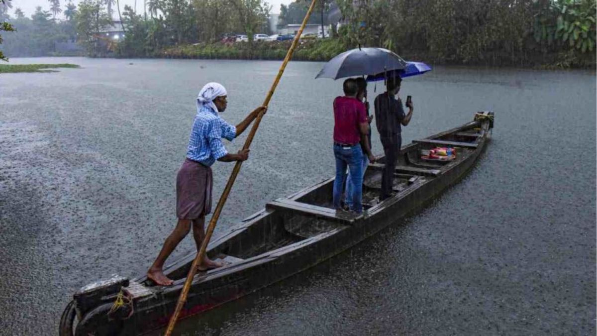
On Tuesday, responding to questions about the flash floods and landslides that claimed more than a dozen lives in Kerala, Chief Minister V.D. Satheeshan acknowledged a key limitation in the state's disaster response: the inability to accurately predict highly localised extreme rainfall events.
"Unlike widespread monsoon rain, cloudbursts and flash-flood-triggering downpours often develop suddenly, leaving little or no time for evacuation. In many cases, warning messages are issued only late at night, further narrowing the response window and exposing gaps in last-mile dissemination and preparedness," he said.
The chief minister also announced that Kerala would implement a disaster management plan that, he said, could serve as a model for the rest of India. The plan envisages the use of the world's most advanced weather forecasting technologies, strengthening the state's alert systems, and undertaking flood mapping of disaster-prone areas.
"As part of this initiative, sand and silt accumulated in dams and rivers will be removed. The Revenue and Irrigation Departments will begin this work immediately after the monsoon recedes," he said, adding that these measures alone could resolve nearly 50 per cent of the existing problems.
Yet the larger challenge extends well beyond better forecasts and infrastructure. As extreme weather events become more frequent in a warming climate, Kerala faces a reality in which building a climate-resilient society through long-term planning, decentralised governance and community preparedness has become as important as, if not more important than, responding to disasters after they strike.
THE WEEK spoke to experts about what such a shift—from reactive disaster response to proactive climate resilience—would require.
Tropic trouble
While the chief minister has promised to strengthen Kerala's weather forecasting capabilities, experts say the state's geography itself poses a formidable challenge. Compared with the extratropics—the colder regions of the world—the tropics are inherently far more difficult to forecast.
According to Neetha K. Gopal, director and head of the India Meteorological Department's Meteorological Centre in Thiruvananthapuram, a key challenge is the highly dynamic nature of tropical weather.
"Weather here can develop very suddenly. Except in the case of organised systems such as cyclones, weather systems in the tropics rarely have a clear directional movement. That makes predictability—how accurately and how far in advance you can forecast a weather event—the biggest challenge," she says.
Unlike the extratropics, where weather systems are driven by large temperature gradients and follow relatively systematic patterns, tropical weather is influenced by subtle changes in atmospheric conditions. "Weather systems in colder regions are much more predictable, which is why forecasts there tend to be more accurate," she explains.
"In the tropics, however, even small variations in wind, temperature or atmospheric pressure can significantly alter weather conditions. In particular, changes in wind direction are among the most important factors determining weather here. Essentially, it is the balance between wind and pressure that governs our weather."
Another complicating factor is diurnal variation—changes in weather within a single day caused by fluctuations in solar heating. "Because these changes are driven by solar radiation, weather conditions can shift considerably even within a day. Seasonal changes, too, are less pronounced in the tropics than in the extratropics," Gopal says.
For Kerala, this means forecasting highly localised cloudbursts and flash-flood-triggering downpours will remain far more challenging than predicting large, organised weather systems, even as forecasting technology improves.
Kerala's unique topography compounds the problem. Sandwiched between the Western Ghats and the Arabian Sea, the state is particularly vulnerable to extreme rainfall. Any event occurring in the Ghats quickly impacts downstream areas. Because the rainfall was concentrated into a very short nighttime window, it became an intense spell that triggered flash floods.
Rain gauges are typically installed in accessible locations, but the heaviest rainfall often occurs deep inside forests and on the slopes of the Western Ghats, where observations are sparse.
"By the time the rainwater flows downstream, flooding depends on the rivers' discharge capacity. During an intense spell of rain, the rivers simply cannot drain the incoming water fast enough. Water levels rise rapidly, resulting in flash floods," Gopal explains.
Global warming has further amplified this risk. A warmer atmosphere can hold more moisture, resulting in heavier rainfall when clouds form. "That is why we are now witnessing more frequent short-duration, high-intensity rainfall events," she says.
Scientists have also observed changes in cloud structure. Increasingly, clouds exhibit stronger vertical development, producing towering cumulonimbus thunderclouds capable of unleashing sudden cloudbursts and torrential downpours.
“As the Earth's atmosphere warms, rainfall patterns are changing. Earlier, the monsoon was characterised by steady, light-to-moderate rainfall. Today, the season is marked by alternating dry spells and short but extremely intense wet spells that are far more destructive,” notes Gopal.
Limited data
Climate change is also exposing the limitations of existing forecasting models. According to Gopal, abrupt weather changes driven by a warming climate are often beyond the models' ability to capture. Another major challenge is highly localised rainfall events. Because forecasting models are designed to simulate large-scale weather systems, they frequently interpret isolated, intense rainfall as statistical noise and suppress it during processing.
"As a result, models perform well in predicting large, sustained weather systems, but often fail to capture highly localised, high-impact rainfall events," she says. "That remains one of the inherent limitations of current forecasting systems."
Dr K.G. Thara, former director of the Kerala State Disaster Management Centre and a disaster management expert, says that in order to improve models for predicting hyperlocal weather events, creating networks involving scientific institutions, govt depts and local communities is important. “The need of the hour is to have ample data. So, the biggest requirement is data collection at the decentralised level.
That is where we are lacking. The data we have right now is not enough for a location-specific action plan,” she says. Notably, even though the state faced a major deluge in 2018 and subsequent flash floods and disastrous landslides in subsequent years, Kerala still does not have enough local weather data collection mechanisms.
Planning paradigm
Instead of relying on the traditional reactive disaster response approach—which responds only after disasters occur—Kerala must adopt proactive resilience planning, an approach that anticipates disaster risks and strengthens local resilience before disasters strike, says Keshav Mohan, former director, Institute of Land & Disaster Management.
“Planning confined to the state or district level alone is insufficient to address the unique geographical and ecological realities of rural areas. Therefore, Kerala needs a new green development framework that places panchayat governments at the centre of climate resilience and disaster preparedness,” he said, while adding that Kerala's internationally recognised decentralisation model can be extended to climate resilience.
“Each panchayat should independently assess its climate vulnerabilities and prepare development plans suited to its local conditions,” he said.
Mohan proposes building "climate-resilient model panchayats" by restoring ecosystems such as wetlands, water bodies and mangroves, promoting local carbon neutrality through renewable energy and scientific waste management, and integrating indigenous knowledge with modern science. He also recommends scientifically documenting successful panchayat-level initiatives so they can be replicated across Kerala.
However, he noted that some decisions can certainly be centralised. “For example, the total budget allocation for disaster mitigation in Kerala can be decided centrally. Likewise, decisions on rescue infrastructure, emergency response systems, and the number and placement of early warning systems can also be made at the state level,” he said.
Experts such as K.G. Thara argue that disaster risk reduction must become an integral part of development planning. However, she says that while policy formulation and overall coordination should happen at the state level through an appropriate nodal agency, implementation must be decentralised to districts and panchayats. Her reasoning is that interventions undertaken by one local body should not create unintended consequences for another, making state-level coordination essential while allowing locally tailored solutions on the ground.
Mohan also recommends a series of state-level interventions, including a complete ban on hill cutting and unscientific earth excavation, restoring river floodplains by removing encroachments, making rooftop rainwater harvesting and groundwater recharge mandatory, and expanding contour trenches, check dams and wetland restoration to improve water management and reduce flood risks. He also calls for the use of advanced technologies such as GIS, remote sensing and LiDAR surveys to prepare high-resolution landslide susceptibility maps for the Western Ghats. Alongside the use of artificial intelligence and machine learning to improve flood forecasting, Mohan advocated deploying IoT sensors to monitor soil moisture and pore water pressure for early landslide warnings. He further recommends adopting international best practices, including nature-based solutions, integrated water resources management for dam operations, and multi-hazard early warning systems in line with IPCC guidelines.
Adopting models
Satheesan announced that the state would adopt the Odisha model for weather forecasting and flood mapping. Notably, this is not the first time Kerala has looked elsewhere for inspiration. In the aftermath of the devastating 2018 floods, the then chief minister Pinarayi Vijayan had hailed the Netherlands' flood management model and said the state could adopt a similar approach. Yet, seven years on, as Kerala continues to face recurring floods, that vision has failed to materialise.
Reports suggest the proposal remained confined to paper after becoming mired in an inter-departmental turf war, with the project stalling before it could move beyond the planning stage. Incidentally, Dutch rivers are larger and more controlled; Kerala’s short, steep, flashy rivers and intense short-duration rainfall require faster response times and more emphasis on upstream land-use control. This means the model should also change accordingly.
Experts like Mohan note that a single model can never be a panacea. “Every region has its own unique geography and environmental characteristics,” he says. “My considered view is that we should adopt the best practices from multiple models, customise them to Kerala's specific conditions, and develop our own approach.
We must take into account many factors together. Focusing on just one aspect will not be enough.” Mohan notes that Kerala has lessons that can be adopted from the sponge city model of China and the Netherlands to mangrove restoration in Bangladesh and Vietnam to community-led landscape management in Meghalaya to watershed development models in Maharashtra.
Societal resilience
Experts argue that extreme weather events in Kerala can no longer be treated as aberrations—they are increasingly becoming the new normal.
"This means society and government systems must adapt so they can respond quickly to the sudden developments brought about by climate change. Adaptation is the key," says Gopal.
"Society has to think collectively about resilience," says Mohan.
"Countries such as Thailand, Indonesia and Japan teach children from a young age how to respond to earthquakes and tsunamis. They know to move immediately to open spaces during earthquakes and to higher ground during tsunamis. In Indonesia, these lessons are even preserved through folklore and traditional songs.
"Kerala, however, historically did not face such severe natural disasters. As a result, disaster awareness never became part of our stories, songs or school education. That can no longer continue. Kerala has now become a climate change hotspot. Training and awareness have therefore become absolutely essential."
Notably, Kerala had previously attempted to integrate disaster preparedness into its education system, but the plans did not move forward. For instance, in 2012, the state government launched Surakshayanam, a programme that Mohan says he headed.
"The initiative assessed Kerala's disaster risks and brought in international experts to recommend solutions. As a follow-up, educational material on disaster preparedness was developed for different age groups—from kindergarten to high school. Picture books introduced disaster awareness to younger children, while older students learned the science behind disasters. These materials were submitted to SCERT for inclusion in school textbooks, but I am not aware of any sustained follow-up," he says.
Meanwhile, Thara points out that the Institute of Land and Disaster Management (ILDM)—an autonomous research and training institute established to build disaster resilience—no longer receives government funding or support.
She argues that disaster management should become a core component across all sectors, including police, fire and rescue, health, agriculture and industry, and should also be integrated into school and college curricula. While resilience-building at the panchayat level already features in several policy documents, "the framework exists on paper, but it has not yet been implemented at the scale or level that is actually needed," she says.